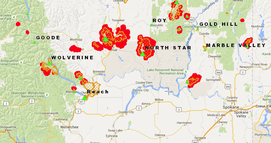
Washington State has been hit hard with wildland fires this season. If you’re interested in tracking the progress of all the fires that are burning around the state, there is a interactive map available for viewing. This online fire and wind map shows most of the fires and it should be updated every day.
You can zoom in for more detail and switch views between satellite or topographic view. If you click a cross hatch fire area, you’ll be able to view information about that particular fire (name, acres burned, percent contained, etc.).